Map & Data
568,000+ points of interest. 12 layers. One map.

The Most Comprehensive Fishing Map Ever Built
Most fishing apps give you a map with some pins. Get Hooked! gives you the most comprehensive fishing map ever built -- 568,000+ points of interest across 12 layers, all rendered on a full-screen floating UI with no fixed bars stealing your screen.
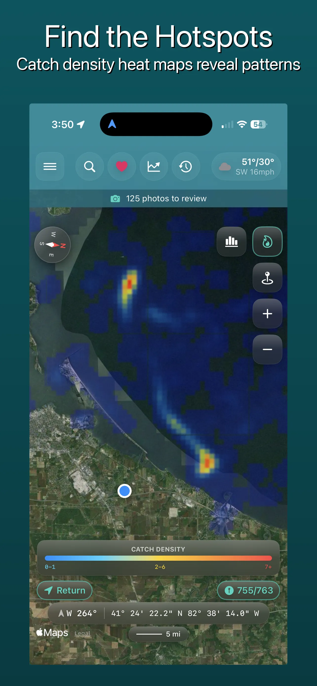
Heat map visualization of your catch density
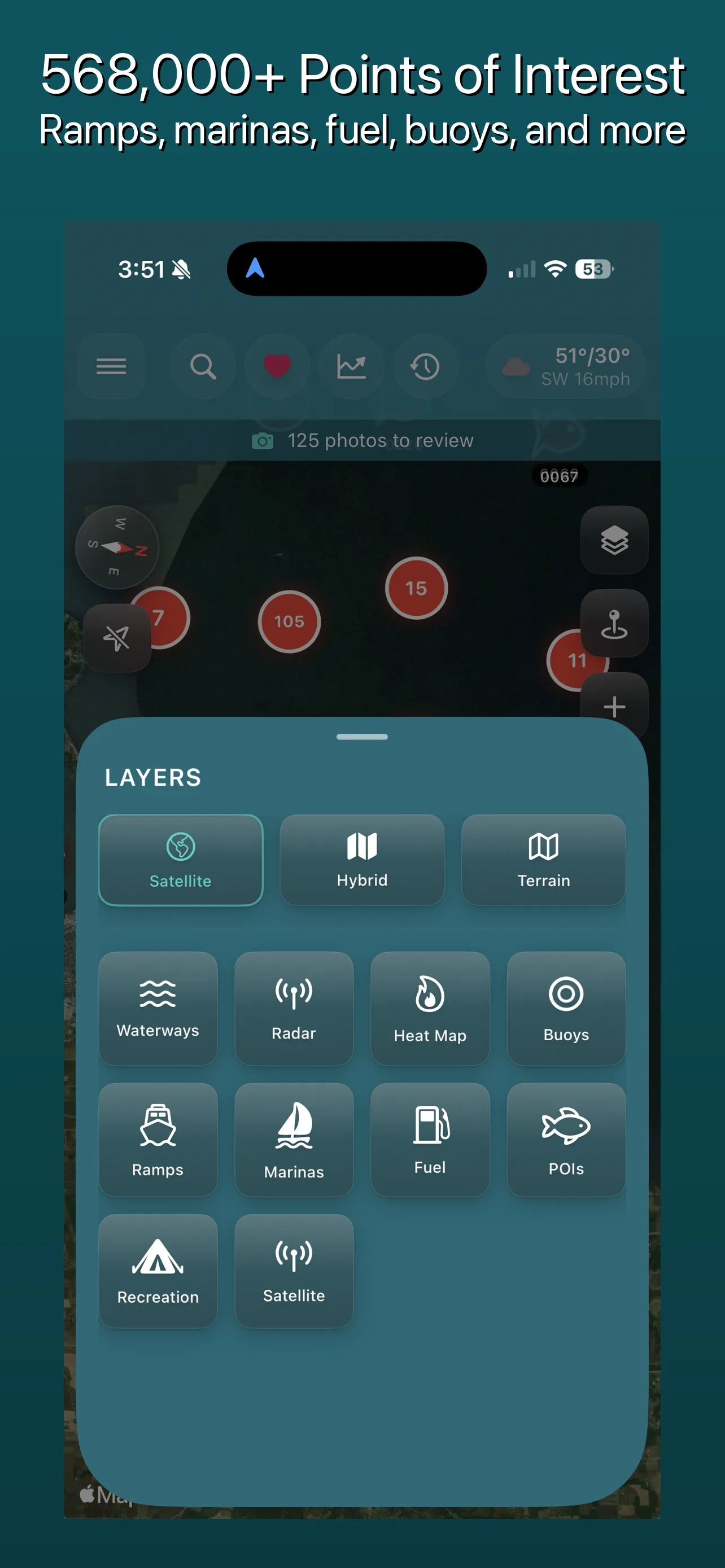
12 data layers at your fingertips
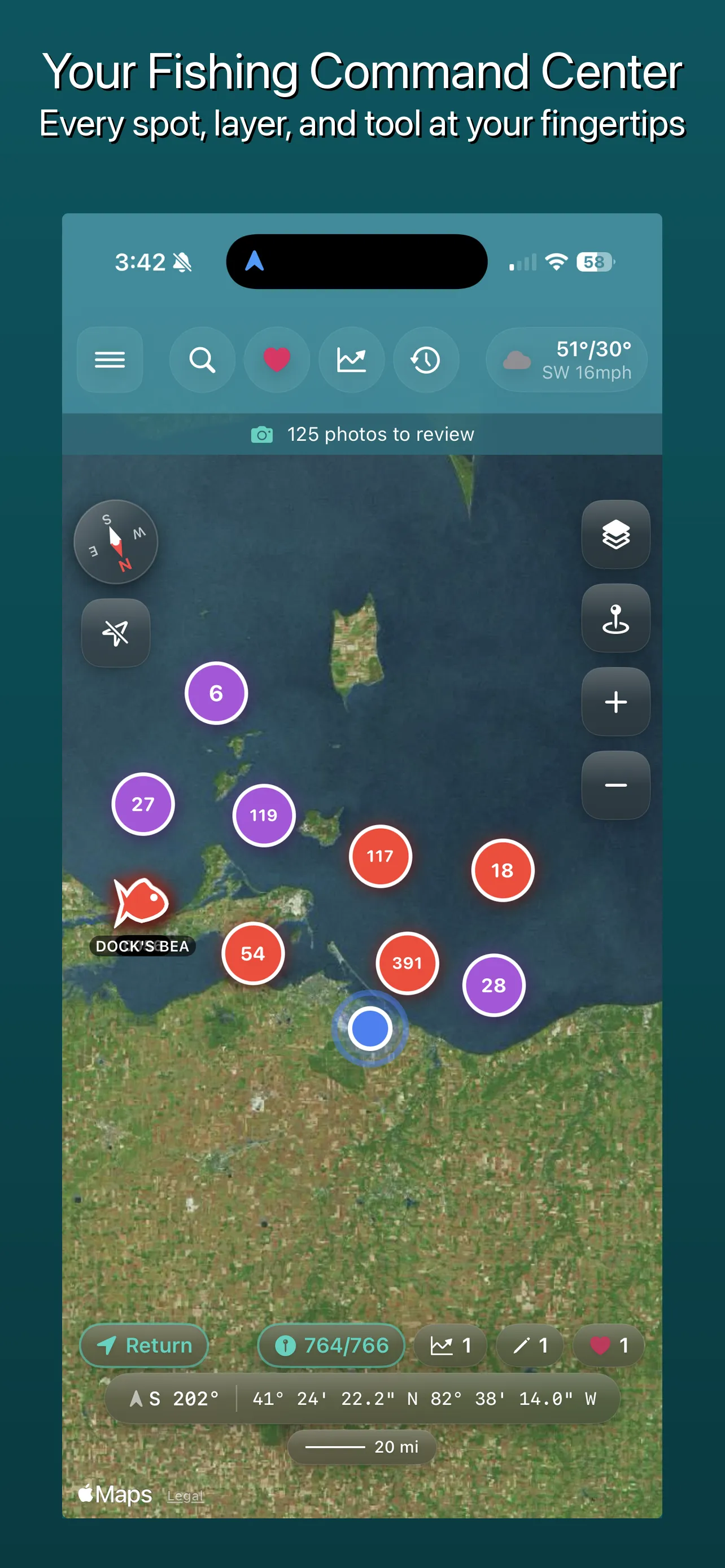
Full-screen floating map with glassmorphism UI
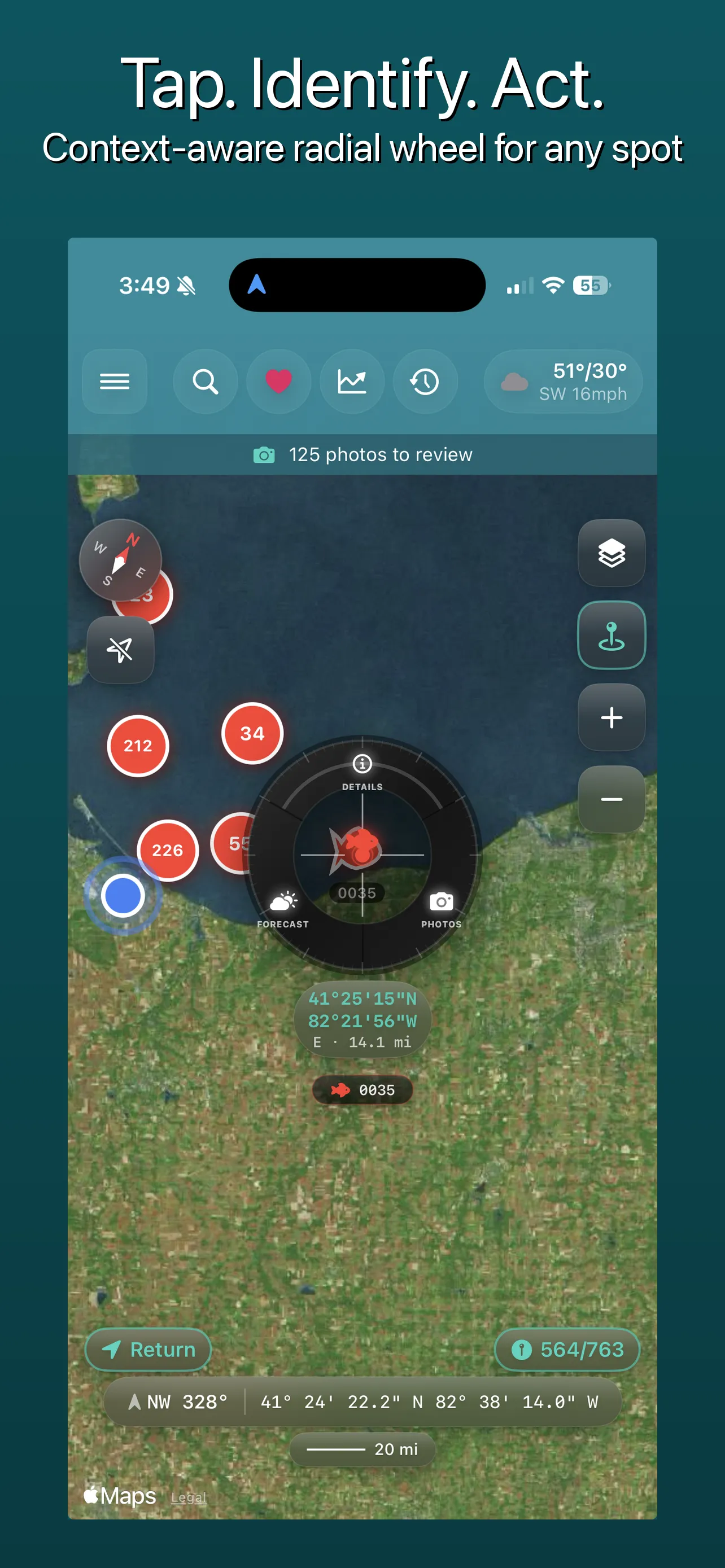
CrossScope measurement with boat context
12 Map Layers
Every layer is toggleable. Stack them however you want.
Boat Ramps
32,000+ launch points with access type and amenities
Marinas
6,600+ marinas with services and facilities -- fuel, repairs, WiFi, showers
Fuel Stations
57,000+ fuel stations with ethanol-free fuel tracking
Fishing POIs
3,500+ fishing shops, guides, charters, and special spots
Recreation
57,000+ campgrounds, 73,000+ beaches, 2,800+ kayak launches, 760+ tackle shops
Waterways
37,000+ rivers, lakes, and reservoirs; 92,000+ dams
Buoys
1,300+ NDBC meteorological buoys with real-time conditions
Charter Captains
Local fishing guide and charter directory
GPX Waypoints
Your imported and saved catch locations
Heat Map
Color-coded catch density visualization
Cloud Cover
Satellite cloud coverage overlay
Weather Radar
Animated rain, clouds, temp, wind, and pressure tiles -- 5 modes
Satellite Imagery
See the water before you get on it.
NASA GIBS Imagery
High-resolution satellite imagery for any US location, powered by NASA's Global Imagery Browse Services.
Great Lakes MODIS
Dedicated MODIS satellite imagery for the Great Lakes region with enhanced water detail.
14-Day Image History
Browse satellite images from the past 14 days, organized by cloud coverage percentage for quick clarity checks.
Weather Metadata
Each satellite image is enriched with weather data. Save favorite satellite locations for quick access.
See water temperature, turbidity, and chlorophyll patterns -- all from satellite data, right in the app.
Heat Map
Your fishing hotspots visualized at a glance.
Gaussian Density Calculation
Catch density is computed from your waypoint data using Gaussian distribution, producing smooth, accurate heat gradients.
QuadTree Spatial Indexing
Fast rendering powered by QuadTree spatial indexing. Thousands of waypoints render without lag.
Red = high catch concentration. Blue = low catch concentration. Your patterns become obvious.
Map Tools
Precision tools built for anglers, not tourists.
CrossScope Measurement Tool
Multi-point distance measurement with great-circle (haversine) calculation. Drop markers to see DMS coordinates at each point. Get boat-context travel time and fuel usage estimates based on your vessel. Save measured routes as GPX tracks for future reference.
Compass
Heading-up mode rotates the map to match your device heading. Directional cone visualization shows exactly where you are pointed.
Search
Unified search across your waypoints and all POI types. Address autocomplete gets you to any location fast.
Favorites
5 favorite categories -- Boat Ramps, Marinas, Fuel, Rivers, and Waterways -- with heart badges displayed directly on the map.
Weather Radar
Real-time radar overlays powered by RainViewer.
Overlay modes: Rain and Clouds
Play/pause animated radar tiles showing weather movement over time
Configurable opacity so you can see the map beneath the radar overlay
GPX Management
Bring your data in. Take your data out. Your catches belong to you.
Import .gpx Files
Import waypoints from fishfinders, GPS devices, or other fishing apps. Your data migrates seamlessly.
Export as .gpx
Export your catch data as standard .gpx files. No lock-in. Your data is always yours to take.
Per-File Color Coding
Each imported GPX file gets its own color on the map for visual differentiation between data sources.
Symbol Filtering & Track Simplification
Hide or show specific catch types using symbol filters. Imported GPS tracks are automatically simplified for clean rendering.
Data Export
We will never hold your data hostage. Export everything, anytime, in three formats.
GPX Export
Standard GPX 1.1 with custom extensions. Load directly onto your Garmin, fish finder, or any GPS device. Human-readable description tags included.
CSV Export
25+ columns including weather data joins and DMS coordinates. Open in Excel, Google Sheets, or any spreadsheet tool for your own analysis.
HTML Archive
Your fishing data as a local portal you can open in any web browser. Interactive map with all your pins, sortable catch table, journal timeline, photos, monthly charts, and per-trip exports -- all in one ZIP file. No internet required. No app required. Just open index.html and browse your entire fishing history on your laptop.
Data Sources
Get Hooked! aggregates data from authoritative public sources to build the most complete fishing map available.
OpenStreetMap
568,000+ points of interest -- boat ramps, marinas, fuel, campgrounds, beaches, and more
NOAA
Tide stations, meteorological buoys, and weather alerts
USGS
Waterways, rivers, lakes, reservoirs, and dam data
NASA GIBS
High-resolution satellite imagery
RainViewer
Animated weather radar tiles
National Inventory of Dams
92,000+ dam locations and details
568,000+ points of interest. 12 layers. One map.
Download Get Hooked! and see every fishing spot, boat ramp, marina, and waterway near you.
© 2026 Hooked on Yutz. Get Hooked! is a trademark of Hooked on Yutz.